Crab Lake

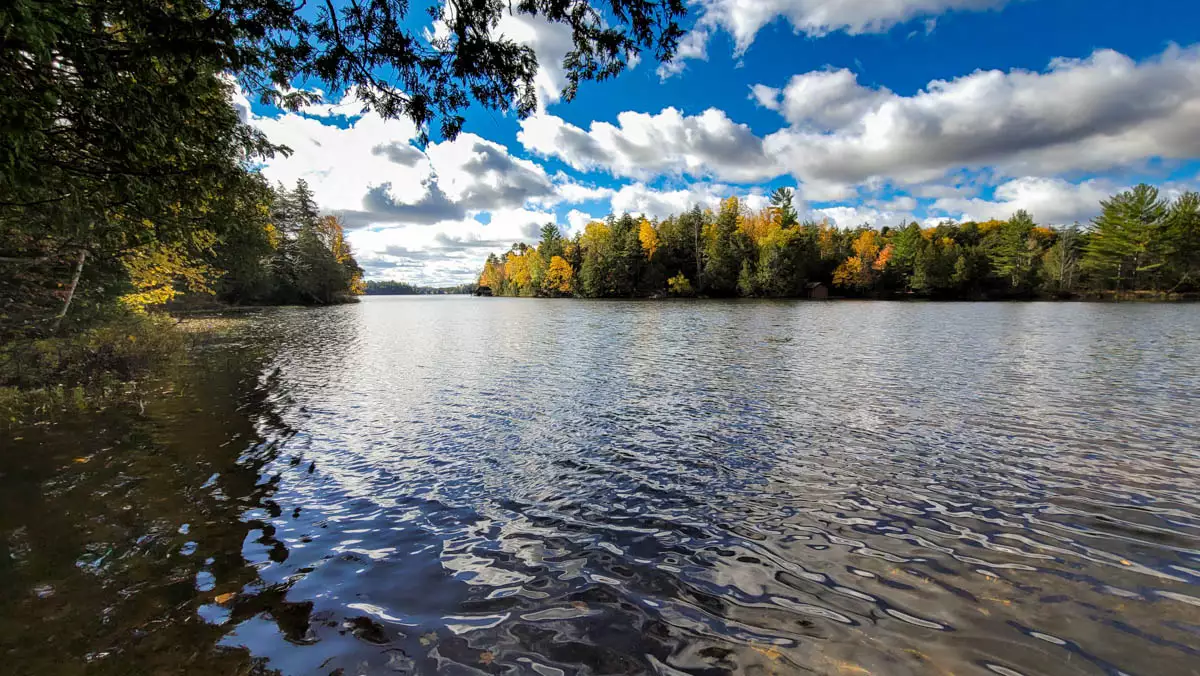
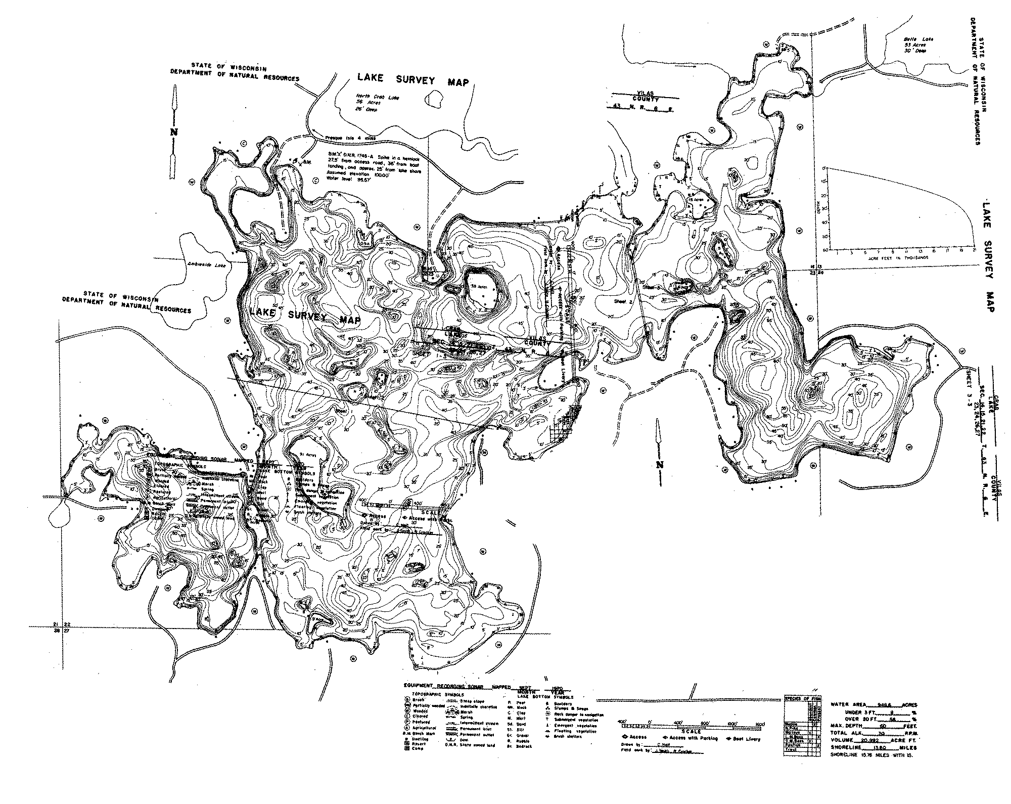
Crab Lake spans 909 acres in the Boulder Junction area and is defined by its meandering 13.6-mile shoreline. Numerous islands, narrows, and winding bays give it one of the more distinctive layouts in the region.
With an average depth of 22 feet and approximately 10 feet of clarity, the lake offers clear water and strong structure for fishing. Development density remains low at roughly 5 owners per mile of shoreline and about 13 acres of water per owner, preserving space and long wooded sightlines.
The complex shoreline creates a paddler’s playground and gives boaters the sense of exploring multiple smaller lakes within one basin. Buyers drawn to Crab typically value space, exploration, and a more intricate shoreline over a simple round-lake layout.
Crab Lake Specs:
Homes for Sale:
Lots for Sale:
Presque Isle - Pomeroy - Henry Trails - Also north of the lake, this system consists of over 100 miles of gravel roads for mountain biking.
Presque Isle / Winchester Bike Route - This paved trail system starts in Presque Isle and can very from 4 to 10 miles depending on the route you take.
Presque Isle Nature Trail - A hiking trail that winds through the forest and past some neighboring lakes. This trail is also located in Presque Isle.
Catherine Wolter Wilderness Area - A hiking/skiing/snowshoe trail of varying lengths located northeast of Crab Lake. Trails wind through a huge wilderness area and around many small lakes.
Van Vliet Hemlocks - This trail system is just west of Crab Lake and loops along 1.5 miles of undeveloped shoreline and through old growth hardwood and hemlock forests.
This is a summary based on available information.
Crab Lake’s depth and clarity support a diverse fish community that can include walleyes, smallmouth and largemouth bass, pike, panfish, and muskies, with structure and islands playing a major role. Points, saddles between islands, and steep drops close to shorelines create natural fish highways and ambush spots, especially in low-light conditions. Clear water often pushes fish deeper during the day, so many anglers focus on early and late periods, working mid-depth breaks and island edges with jigs, live bait, and crankbaits. For cabin owners, Crab Lake offers a “big water, big structure” feel where learning the map and following seasonal movements is part of the fun and leads to rewarding multi-species fishing.
How big is Crab Lake?
Crab Lake is 909 acres with 13.60 miles of shoreline.
How deep is Crab Lake?
Crab Lake has an average depth of 22 feet and a maximum depth of 60 feet.
Does Crab Lake have a boat launch?
Yes, Crab Lake has a public boat launch.
How far is Crab Lake from Boulder Junction?
Crab Lake is 26 minutes from Boulder Junction, Wisconsin.
What fish are in Crab Lake?
Crab Lake contains a Variety of fish species including Musky, Panfish, Largemouth Bass, Smallmouth Bass, Northern Pike, Walleye.
What is the water clarity of Crab Lake?
Crab Lake has a water clarity of 10.0 feet.
How long is the shoreline on Crab Lake?
The shoreline of Crab Lake is about 13.60 miles.
What type of lake is Crab Lake?
Crab Lake is a Drainage lake.
What is the trophic status of Crab Lake?
Crab Lake is a Oligotrophic lake.